Flood Modelling in Dominica, Grand Bay Watershed Comparison
Modelling Extreme Flash Floods on Dominica: FastFlood Meets Saint-Venant
In the autumn of 2017, Hurricane Maria made landfall on Dominica as a Category 5 storm, delivering over 500 mm of rainfall within 24 hours to its steep, mountainous terrain. The intense rain triggered widespread flash floods and landslides across the island. Among the hardest hit regions was the southeastern watershed around the town of Grand Bay.
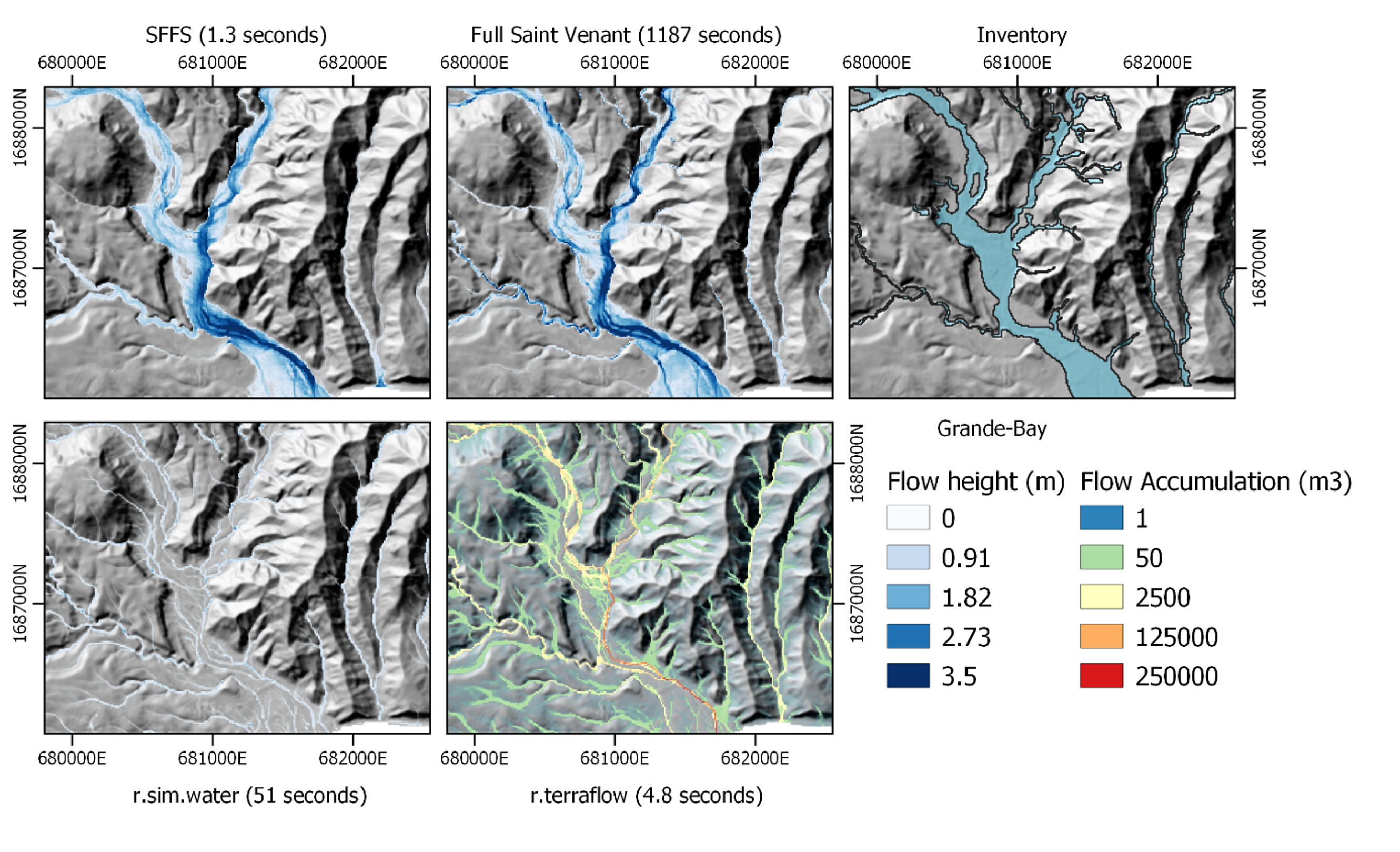
To assess and compare different flood-modelling approaches for such a rapid and extreme event, we simulated the Grand Bay catchment using both FastFlood, our rapid-response flood model, and a full dynamic Saint-Venant solver, representing a detailed hydrodynamic benchmark. Both models were supplied with identical hydrology and precipitation inputs.
High-resolution LiDAR terrain data (resampled to 10 m), Manning’s surface roughness (from field observations and the USGS field manual), and land-use maps from Sentinel-2 imagery were used to characterise the watershed. Rainfall data from Canefield Airport served as the boundary forcing for the event. For calibration, a brute-force parameter search was applied.
The results showed that FastFlood achieved comparable accuracy to the full dynamic solver, with an average computational speed-up of about 1500×. This performance demonstrates FastFlood's ability to balance speed and accuracy, making it especially suited for rapid hazard assessments and scenario testing.
Further comparison with other rapid-modelling tools (such as r.sim.water and r.terraflow) highlighted that these methods were less effective at capturing complex flow paths and significantly slower in computation. This underscores the high-performance potential of FastFlood as an alternative when time or computational resources are limited. In conclusion, the Grand Bay case study in Dominica illustrates that FastFlood can reproduce detailed hydrodynamics at a fraction of the computational cost.
With the launch of FastFlood Global, we have further enhanced model speed, stability, and scalability, enabling users to simulate flood events worldwide with unprecedented efficiency.
Image Credit: DFID - UK Department for International Development