Flood Modelling in Northern Thailand ,September 2024
Mapping Northern Thailand’s September 2024 Floods with FastFlood
In the latter half of September 2024, northern Thailand experienced extreme rainfall that pushed rivers well beyond capacity across vast stretches of the North and North‑East. The deluge intensified by the passage of Typhoon Yagi and persistent monsoon downpours inundated provinces such as Chiang Rai and Chiang Mai, triggered destructive landslides, stranded thousands, and left dozens dead. The economic impact was significant: damage across 37 provinces (mainly in the north and northeast) was estimated at some THB 46.5 billion (about 0.27 % of Thailand’s GDP)
Flood modelling for this event followed the standard FastFlood workflow, which leverages global and satellite-based datasets to parameterize landscape, precipitation, and hydrologic conditions. The model incorporates soil infiltration estimates and an embedded river channel database to simulate how water moves across the landscape efficiently and accurately.
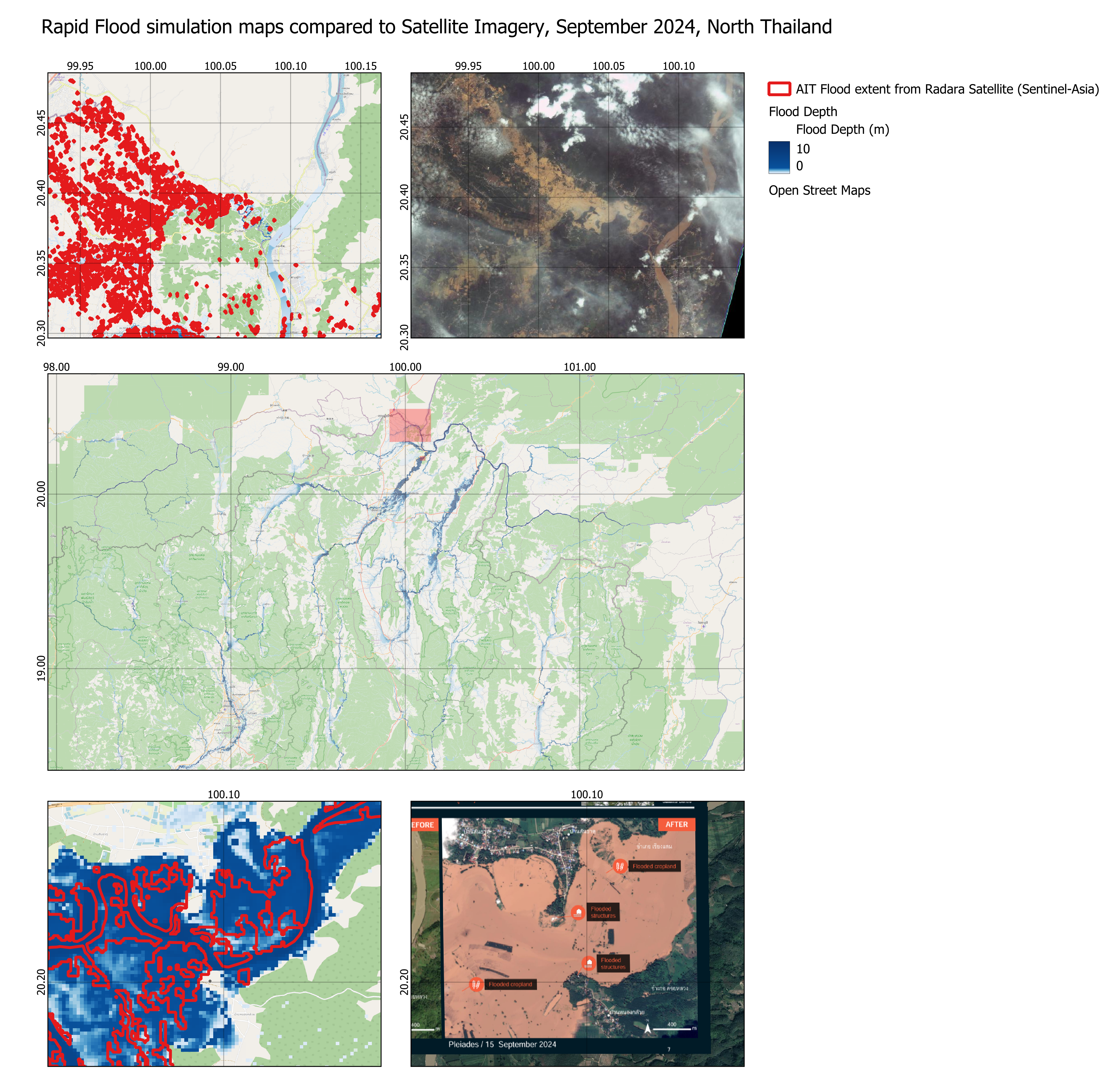
Using FastFlood, the September 2024 flood event was simulated to estimate peak flows and flood depths across affected regions. The model benefits from advanced numerical methods and high-resolution global datasets to deliver rapid and detailed results. Calibration and validation were performed using available observational data, including flood extents derived from radar and optical satellite imagery. In particular, estimates from the AIT Sentinel-Asia platform were used to verify model performance.
Modelling Results
The FastFlood simulations highlight the widespread impact of the September floods in Northern Thailand. Model outputs closely match observed flood extents captured by UNOSAT and UNITAR through the Pleiades and Sentinel-2 constellations.
Comparisons with ALOS-2 radar satellite data show that while the radar-based estimates capture some of the flood extent, they significantly underestimate peak inundation in several areas. Differences are likely due to the timing of image acquisition, noise, and artefacts that can interfere with accurate water detection. Overall, the FastFlood model successfully reproduces observed flood patterns and provides detailed depth and flow information critical for understanding flood dynamics in the region.
Image Credit: Lillian Suwanrumpha/AFP/Getty Images