Geul River Flooding, Netherlands, 2021
Reconstructing the Geul Flash Flood with FastFlood
In mid-July 2021, extreme rainfall across western Europe triggered catastrophic flooding, severely affecting the Geul River catchment in South Limburg, Netherlands. The Geul, a steep, fast-responding stream in the Meuse basin, experienced unprecedented flows that overwhelmed banks and inundated urban centres such as Valkenburg aan de Geul. Damage in the region was estimated in the hundreds of millions of euros; for instance, one estimate placed damage in Valkenburg alone at approximately €400 million. We reconstructed the event using FastFlood.
Modelling Procedure with FastFlood
We leveraged available high-resolution LiDAR terrain data for the Geul catchment (The Netherlands), which, thanks to the national “AHN” datasets, provides centimetre-level vertical accuracy across the region. This LiDAR surface was combined with local hydrometric station data (including discharge and water-level measurements from monitored gauges in the Geul watershed), rainfall data from KNMI and globally accessible datasets hosted in FastFlood (for example, land cover, infiltration). In practice, the LiDAR DEM enabled us to capture fine terrain features—valley slopes, floodplain micro-topography, embankments and urban morphology that strongly influence how flood waters spread and accumulate. The station data provided ground truth for boundary conditions (inflows) and initial wetness states, while the global datasets filled gaps in parameterisation (e.g., land-use based roughness, infiltration defaults, remote-sensed rainfall).
Model Output vs Observations
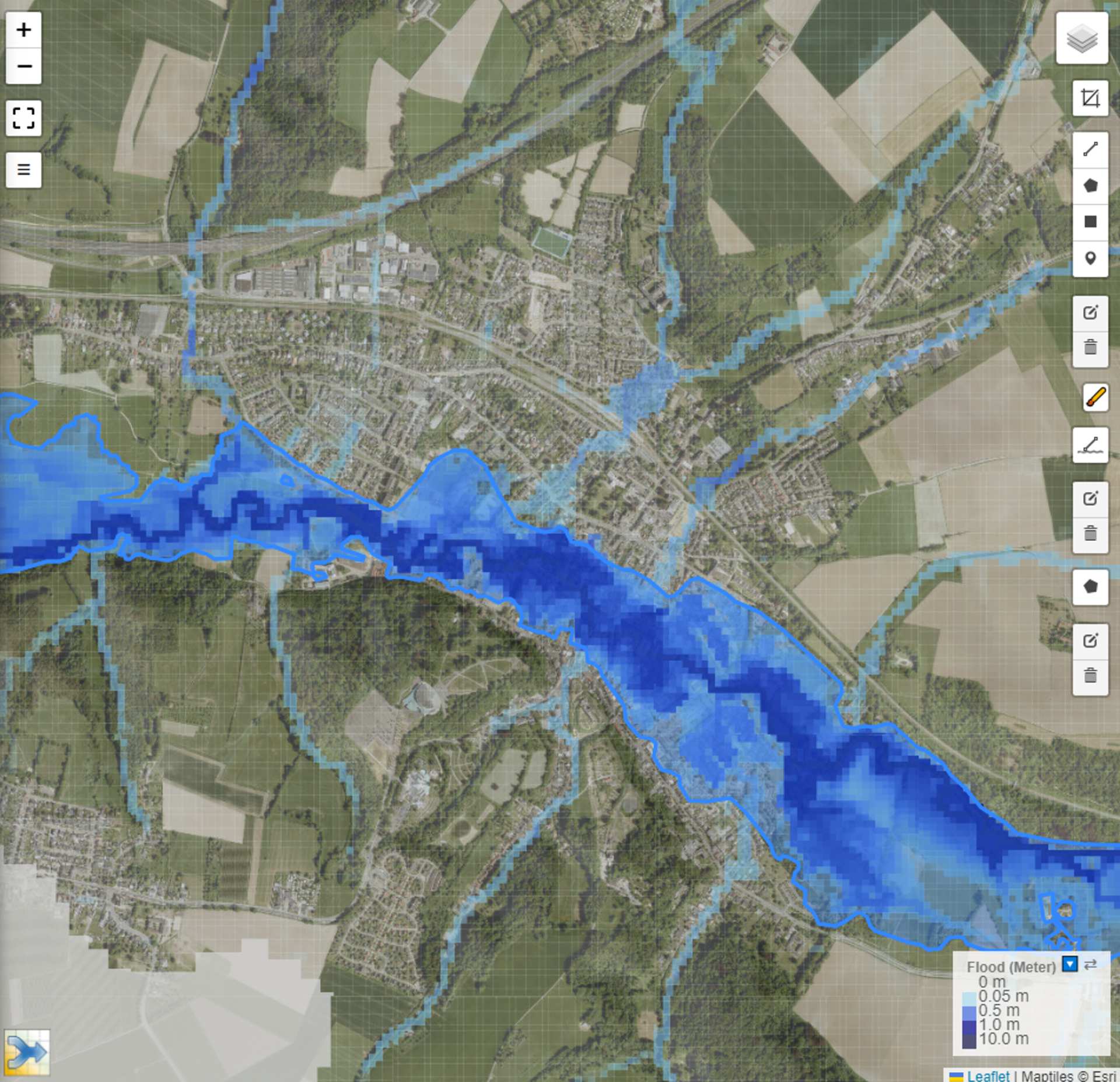
The FastFlood simulations for the Geul catchment produced flood maps that closely aligned with observed flood extents, as derived from satellite imagery and reported inundation areas in Valkenburg and surrounding towns. In particular, the comparison (illustrated in the figure on the top right) shows the observed flood outline (blue line) overlaid with the modelled results, demonstrating a strong spatial match. Beyond just the flood extent, the simulated discharge values at key gauging stations also closely matched the observed flows, confirming that the model accurately captured the flood event. Overall, these results highlight the reliability of FastFlood in reconstructing complex flood events.
Image credit: NRC